A map, an hour's lunchbreak and a stumble across Camelot.
There's always something about turning to look at an Ordnance Survey (OS) Map for knowldege and inspiration. More than meets the eye, it can be read, but also translated into a story or the potential for one.
I was working in South Somerset and had an hour for lunch before the journey home. I needed to stretch my legs having stood behind a theodolite for the last three days. Looking at the local OS map I scanned the yellow and white lines of roads and lanes criss-crossing the page in front or me like the veins of a leaf. Towns and buildings stand out as squares and built up little pockets of communities.
The contours of a map are where the real magic lies however. The swathes of subtle brown loops and curves. They lead the eye up and down dale, over plains and up to steep crags. To the map reader the contours are everything. They paint the picture of the landscape or prise it off the page into a 3D model. Anyway, I digress from my lunchtime sojourn.
Maps also are particularly good at noting features or places of interest. One particular feature close by jumped out at me both in it's contour form and its highlighted italic text, Cadbury Castle. A castle to explore, that's where I'm headed, an achievable walk with a round loop, perfect for an hour's lunch break.
Driving towards the castle it became very clear where I was heading. Surrounding the country lanes were rolling hills and deep set hedgerows, but standing proud of all of this was a hill like no other. A combination of woodland and grasses, it jumped straight out of the landscape, towering in places with steep banks. I'm not sure where our desire to climb things comes from. Maybe its a deep-set genetic sense of safety from being on the highest vantage point. I know on Dartmoor I don't always have a yearning to reach the peak, if only just to view what's over the other side. But this hillock was calling out be conquered. You want to be at the top: for the view, for the intrigue, for the satisfaction of saying “Yes! I'm at the top! King of the Castle!”.
Arriving at the car park, which is also noted on the map, I headed to the info board to read about where I was. Only flippin' well Camelot, that's where!! Or as legend has it. ..
It was first linked to the legend of King Arthur and his famous Camelot in 1542 by a renowned British author John Leland. He wrote in his account of Ancient British History “At the very south end of the church of South-Cadbyri standeth Camallate, sometime a famous town or castle… The people can tell nothing there but that they have heard say Arthur much resorted to Camalat…” The site has been contested much over the last 500 years. Some dispute Leland's writing suggesting he invented the correlation.

“A castle to explore, that's where I'm headed'“
However, archaeological digs took place in the 1960's, verifying it had originally been in use as an Iron-Age camp. It was then refortified with timber and earth during the 6th Century. This is the period in history when King Arthur, his famous court, Camelot and the Knights of the Round Table were in prominence. The foundations of ramparts, an extensive Timber Hall, an unfinished large church and the proximity to Glastonbury Tor all add weight to the words of Leland. In fact there is a causeway that links the North side of the Castle defences to Glastonbury Tor some 11miles away, and this land-bridge is known as “King Arthur's Hunting Track”.
Whatever the truth in the links to Arthur there is no doubt this was a fortress in use from some 3000BC. A spectacular hill fort town with links for trade, craft and worship. Even used as a stronghold for minting coins during the reign of Ethelred II and the threat of Viking invasion.

“immediately you see an altogether different highway rising up and away from you”
I filled my pack with the essentials: Mooorswood Ramblers Roll, water, tea kit, lunch, spoons and strode off towards the collection of old buildings at the base of the hill. There was little doubt about what some of the local residents believed. Some thatched cottages named 'Camelot View' and 'Castle Camelot'. Turning towards the hillock and off the tarmac road, immediately you see an altogether different highway rising up and away from you. Cobbled or stone path'd, it narrowed and steepened as you quickly left the few homes behind. The hedgerow foliage hollowed around me, cutting out the surrounding noises and I was transported back in time. Hearing horses hooves and carts wheeling up behind me, the mixture of current livestock hoof-prints and bootprints still present. Imagining soothsayers, travellers and farmers trudging or hauling up the narrow road to the heights above.
On approach the fortified timber ramparts are now replaced with tall majestic beech and other native trees. They tower over you as you follow the single track to the castle and what may have been high-walled gates or defences. It certainly feels quite intimidating, the pass snaking up between the two tiered banks and defences. The stoned path reached a pinched arrow point where the top banks drew in around, and I heard in my head “Who goes there?, Be it Friend or Foe?” Which of course is a silly question to ask for whoever should have answered Foe would have been slain on the spot from all the archers overhead, or covered in whatever buckets of slop lay to hand.


I pushed on, eager now to breach the top defences and view the majesty of the hilltop. Breaking cover of the trees the light and space opens up, wide, big and now lush green. Cows graze nonchalantly ahead of me, oblivious to the majestic setting of their vivid green carpet. I pause and breathe for a moment or two, it feels special.
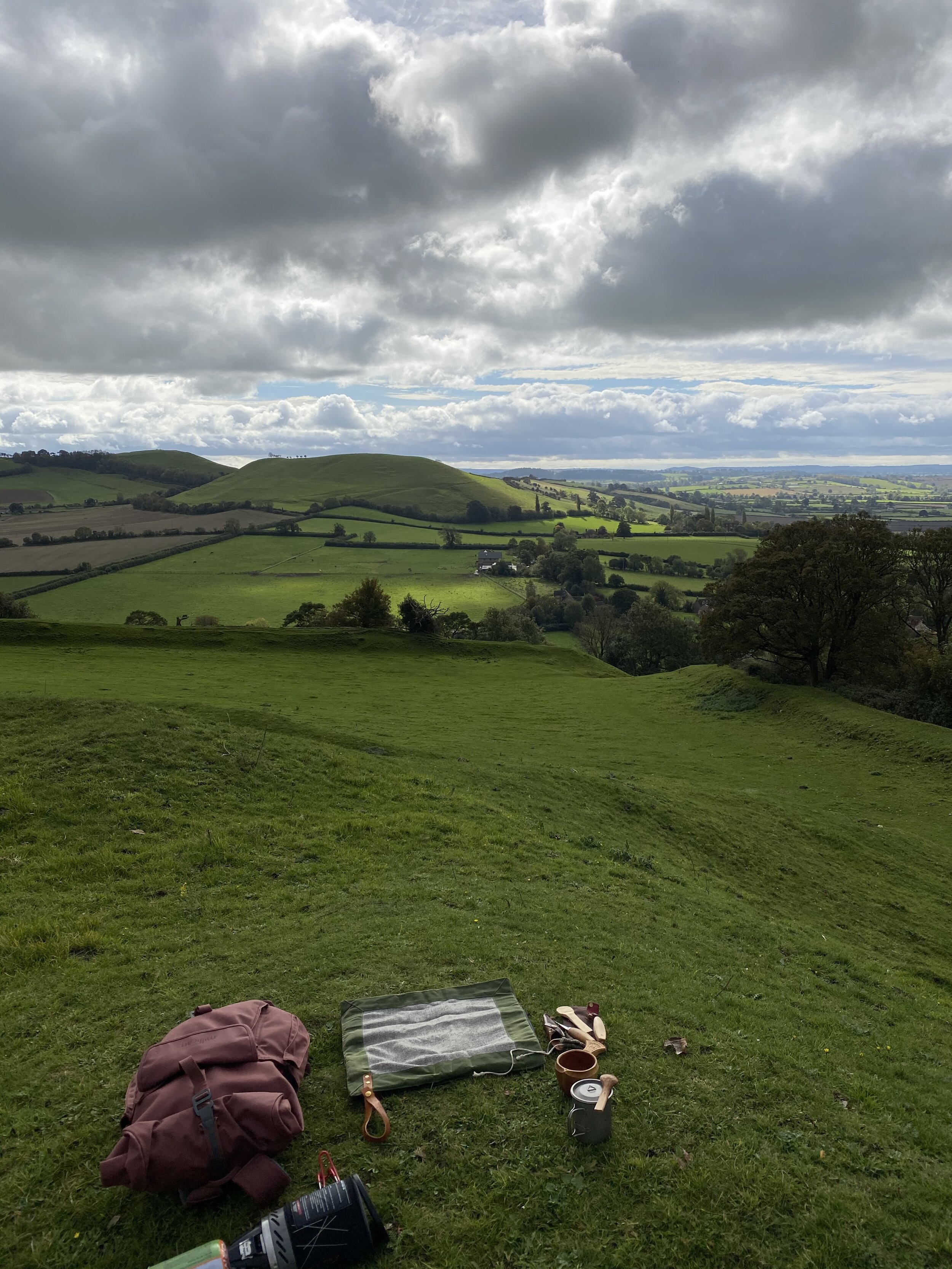
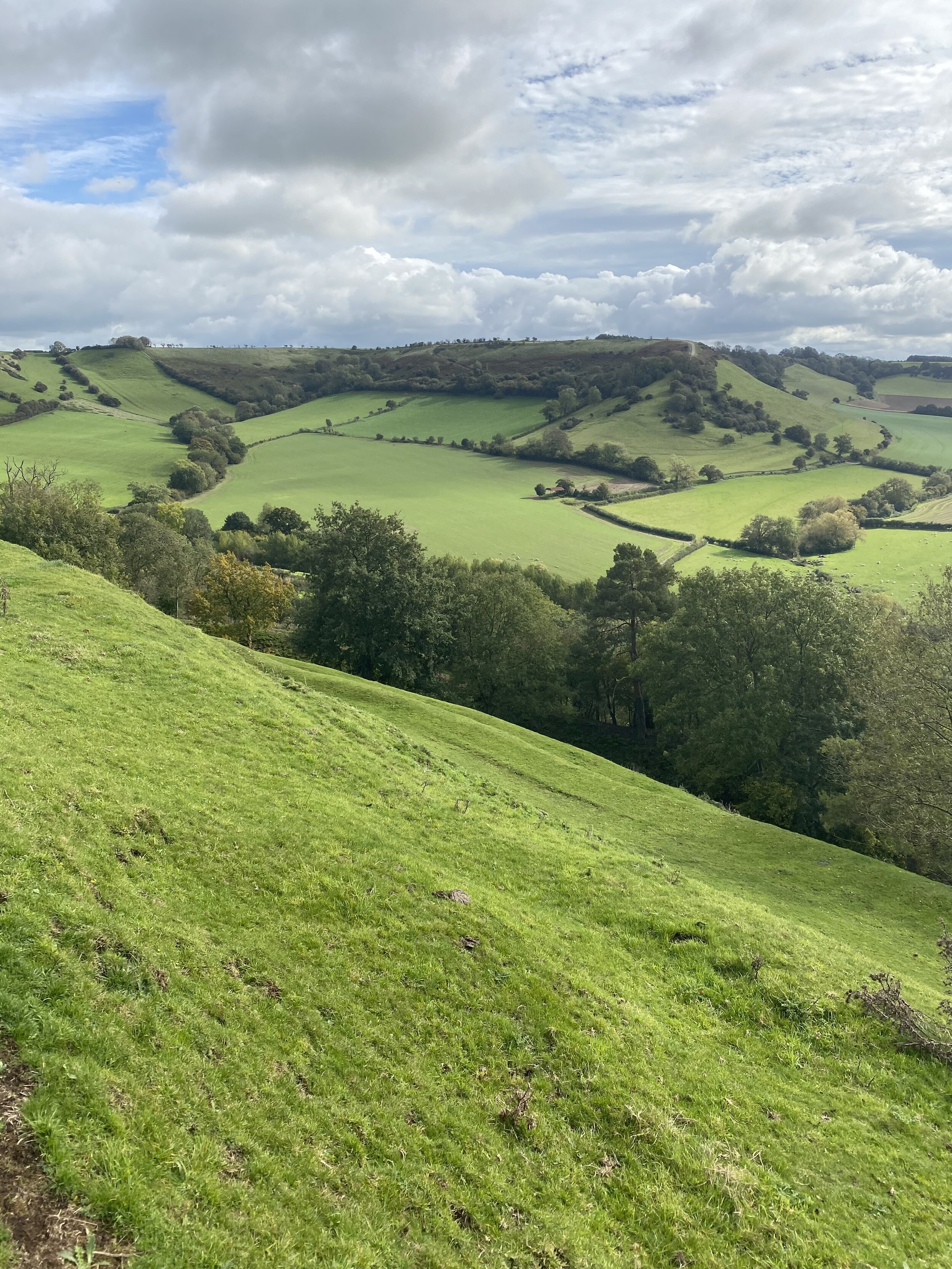
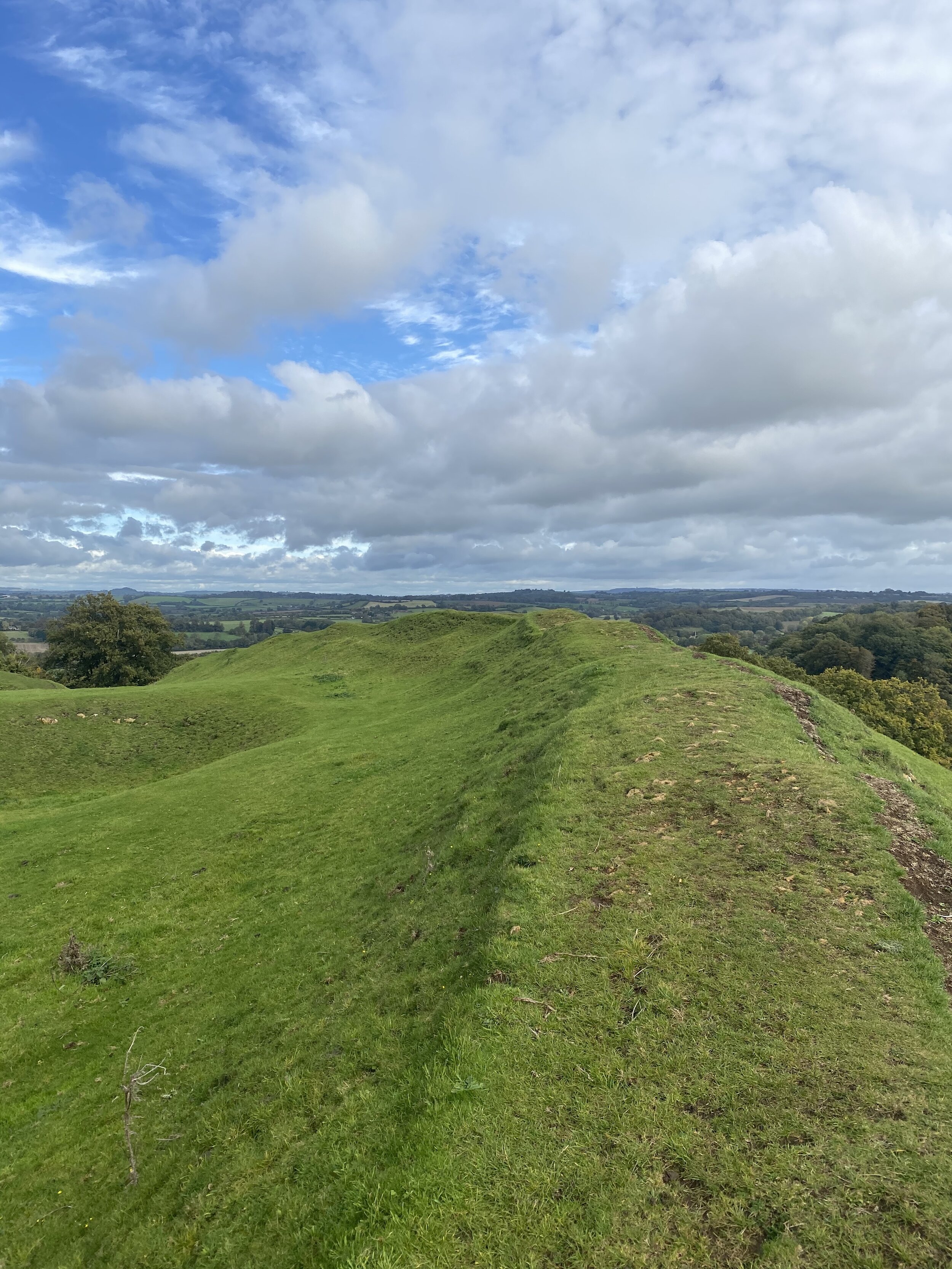
There where two raised banks heading off either side of me and the land in-front rose gently, open now of course with no signs of anything that once was. I turned to the right and decided to follow the outer raised rampart to the North-West. Climbing up onto the bank the steepness and drop below took my breath away. For anyone that has visited other Castles such as the nearby neighbour of Maiden Castle in Dorset. The ramparts and ditches are truly magnificent in their stature and magnitude. I walked on the edge aiming to circumnavigate the ramparts of Camelot, staying high and admiring the aspect of the height it allowed. Below there were at least one maybe two sets of steep banks and ditches. I was above the tree canopy of the masterly beeches that claimed those banks, so it gave me an indication of the gradient and height of the final rampart bank to the top on which I strode. The land stretched out away from the Castle, fairly flat and unassuming, a jumble of modern life and quiet countryside pockets. As I walked on, there in the distance, standing like a lighthouse across the seas, was Glastonbury Tor. I was amazed at how close it was really, and easily rideable or walkable in a journey by the crow's fly. I remembered the knowledge of King Arthur's Hunting Track linking the two and imagined the posse's riding out on the hunt or the travel between them.

As I walked on, there in the distance, standing like a lighthouse across the seas, was Glastonbury Tor. (Viewed on the left hand side of the image on the horizon)
Continuing my wander round to the west I looked back across the Castle, the ground was still slightly rising, it was a huge area of something like four football fields in the round. I wondered where the remains of the Timber hall had been found. I predicted it must surely have been at the very top and now near the highest point of the rampart I cut a bee line for it. The cows, chewing the cud lay and watched my progress among them with neither discord or interest. They had a happy patch of land and didn't seem interested in the usual comings and goings of Authorian legend hunters.
I took in the millennial monument citing distance and bearing to other noteworthy land features of that era: Tintagel, Maiden Castle, Avebury amongst others. The views of the surrounding countryside were complete. However, one would have expected lookout posts at compass points on the ramparts rather than from back here in the centre of the castle ring. There would have been far too many huts, timber buildings, forges and the like to have a clear view from the top, but it really gives you a sense of the enormity of the site and location.
I walked back towards the ramparts and chose a place to pause in the sunshine, with a view out towards the west. The ground was fairly damp and I was glad of my trusty Moorswood Ramblers Roll. A pew with a view, time for lunch and a cuppa. Sitting high up in the grounds and waiting for the kettle to boil, I thought about the hardship of living up here whenever the period in history. Everything would have had to have been brought up by cart, horse or hand.
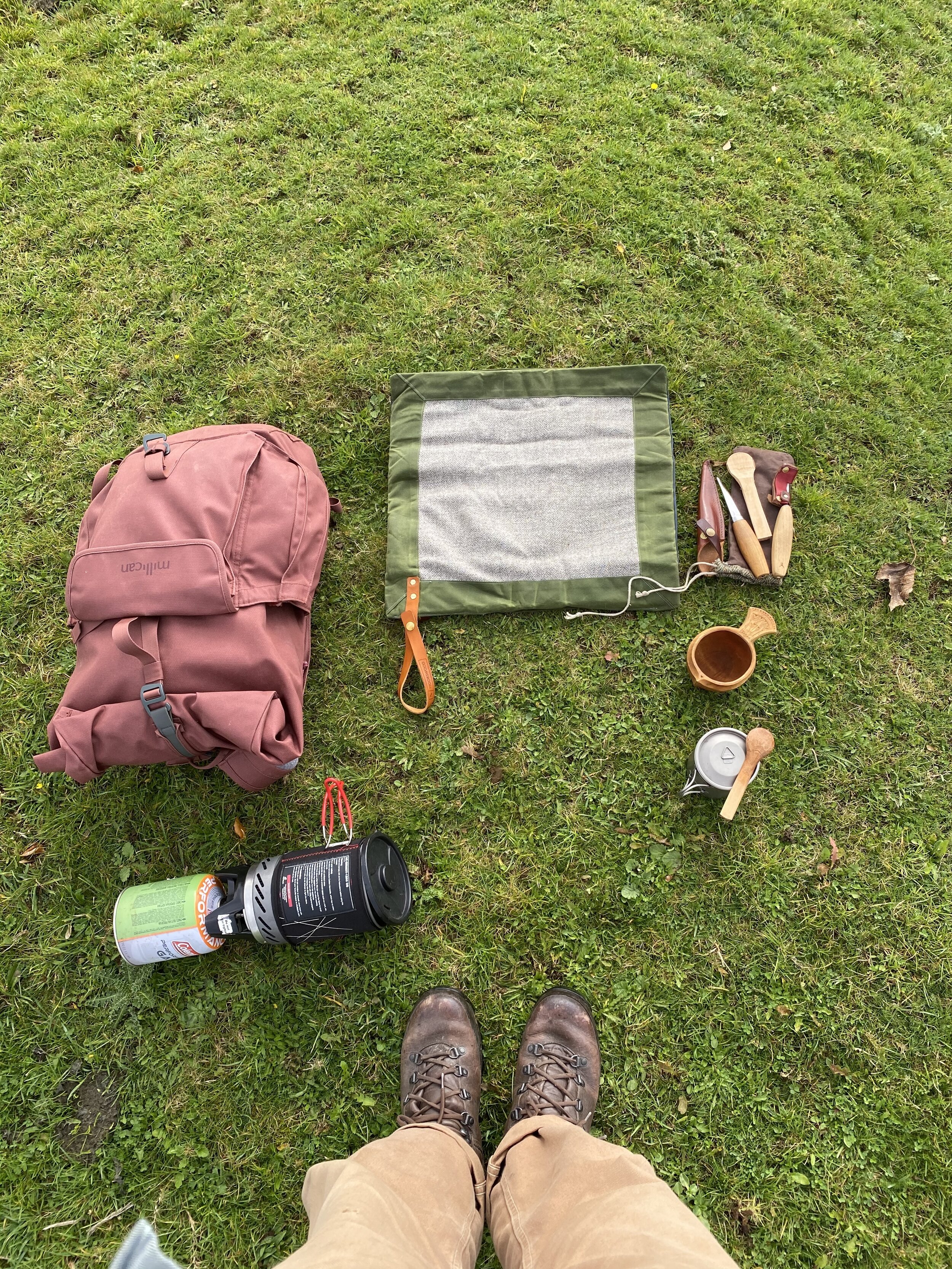
I unpacked my spoon carving knives and sat for a while crafting a small pocket spoon. I am huge fan of any form of hand craft but for me spoon carving is an art form I keep coming back to. It doesn't matter what you are trying to carve, the beauty is all in the making. I can get lost in it. There's a calmness and focus that draws you in. You have to be there in the moment. Even just for the very fact that the knives you are using are so very sharp that they can take your finger off, they demand your attention. The perfect form of mindful creativity. Whilst I sat, carving and supping tea from my beautiful hand carved cup, the clouds drifted by and for a moment I was lost in a pocket of time that could have been long ago. However the sound of a helicopter brought my attention back to the here and now. I reluctantly packed up my kit, rolled and stowed my Rambler and wandered on to the south side of the ramparts.
Here it was incredibly steep, dropping away in a rush and flurry of stone and steep grass bank down to the next rampart and another steep drop. You could see why laying siege to places may well have been a better prospect rather than an attack, for none would have been able to easily run up or climb these hills.
I am always a little lost in my own thoughts after a cuppa and a little wild carving, so I don't have much to write here. I just calmly walked on admiring the view and basking in the early Autumn sunlight. The tops of the trees around where starting to turn, oranges and bronze replacing green. Upon completing the circuit of the ramparts I looked back up into the castle and saw a solitary cow dominating the skyline. The new King of the Castle and along with her fellows a new set of inhabitants to this once crowded and important site.
The stoned path back down felt suitably eery, heading into the holloway and out the other side. Released back into society from a little transported glory. I was brimming with good humour as I often am after a brief adventure. I don't often get to explore such an ancient monument but my oh my it is always so worth taking the time to do so. There is so much to be gained with a map, a pair of walking boots and an hour to spare. Looking back at the immense land feature it was almost certainly now a Castle more dominant of nature than of man, but I was still so glad to have conqeured it all the same.

“Truly me seemeth it is a Mirackle in bothe Arte and Nature” John Leland 1542.
References:
Image Copyright @Ordnance Survey Mapping
South Somerset District Council Leisure and Recreation Department 1988
King Arthur's Knights by Nathan Currin https://kingarthursknights.com